Perranuthnoe
VillageTR20St Ives
Image may be sourced from Wikimedia Commons. If you know the original attribution, please suggest an edit.
8Listed Buildings
1Beaches
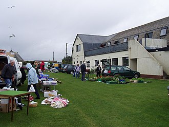
About Perranuthnoe
Perranuthnoe sits on the east side of Mount’s Bay in southwest Cornwall, a village and civil parish that forms part of the TR20 postcode district. The parish — recorded with a population of 2,184 at the 2011 census — embraces a small cluster of settlements: Goldsithney, Perran Downs, Perranuthnoe itself and part of Rosudgeon. Located roughly one mile east of Marazion and about four miles east of Penzance, Perranuthnoe offers an intimate base for exploring this corner of Cornwall’s South West region. Its coastal position on Mount’s Bay places the village within easy reach of nearby towns while remaining firmly rooted in the parish community. Whether arriving from Penzance or visiting neighbouring Marazion, the layout of the parish invites a close look at the settlements that together make up this part of Cornwall’s landscape. For those seeking a compact, well-situated village experience on the Cornish coast, Perranuthnoe provides a clear sense of place within the county of Cornwall.
Read more on Wikipedia →Postcode
TR20
Constituency
St Ives
Ward
Penzance Promenade, Porthleven, Breage & Germoe, Penzance East, St Ives East, Lelant & Carbis Bay, Land's End, St Ives West & Towednack, Long Rock, Marazion & St Erth, Mousehole, Newlyn & St Buryan, Ludgvan, Madron, Gulval & Heamoor
Attractions
Perranuthnoe Beach
beachPerranuthnoe Beach is a memorable stretch of Cornwall coast near Perranuthnoe, known for its sand, Atlantic light and easy access to the sea. Depending on the tide and weather, it can feel either wild and dramatic or calm enough for a slower beach day, with coastal paths and cliff views adding to the appeal.
Dog friendlybeachvillagecoastaloutdoor
0.0 km
Listed Buildings
Nearby Beaches
0.3 km