Bohortha
HamletAbout Bohortha
Postcode
TR2
Constituency
Truro and Falmouth, St Austell and Newquay
Ward
St Goran, Tregony & the Roseland, Probus & St Erme, St Mewan & Grampound, St Stephen-in-Brannel, St Dennis & St Enoder, Truro Boscawen & Redannick
Attractions
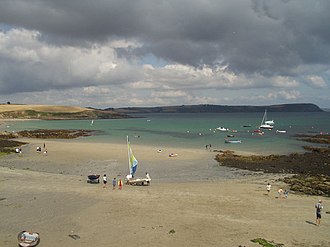
St Anthony Head
naturalSt Anthony Head is a worthwhile natural stop near Bohortha, valued for open views, sea air and the kind of landscape that gives Cornwall much of its identity. It rewards slow exploration, whether that means a clifftop walk, a pause at a viewpoint or simply taking in the changing weather and light.
Dog friendlyThe lighthouse at the tip of the Roseland Peninsula has guided ships into Falmouth's great harbour since 1834. The headland around it — managed by the National Trust — was fortified in the 1890s and again in the Second World War; the gun battery and observation post have been restored and offer views across Falmouth Bay that are among the most commanding in Cornwall.
Dog friendly