Nanpean
VillagePL26Truro and Falmouth, North Cornwall, St Austell and Newquay
Image may be sourced from Wikimedia Commons. If you know the original attribution, please suggest an edit.
1Listed Buildings
About Nanpean
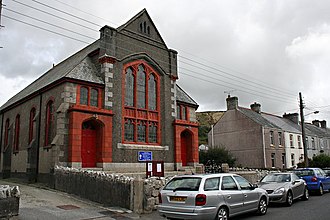
Tucked into mid-Cornwall’s distinctive landscape, Nanpean is a village within the civil parish of St Stephen-in-Brannel. The B3279 road threads through the settlement, placing it roughly four miles northwest of St Austell. Nanpean sits at the heart of ‘clay country’ — the china clay mining area that defines much of this part of Cornwall. Visitors approaching along the B3279 find themselves in a place shaped by its industrial heritage and rural setting, within the PL26 postcode district and the county of Cornwall in the South West region. Compact and quietly rooted in its surroundings, Nanpean offers a clear sense of place for those exploring the china clay landscapes of mid-Cornwall.
Read more on Wikipedia →Postcode
PL26
Constituency
Truro and Falmouth, North Cornwall, St Austell and Newquay
Ward
Roche & Bugle, St Goran, Tregony & the Roseland, St Austell Bethel & Holmbush, Penwithick & Boscoppa, Mevagissey & St Austell Bay, Lanivet, Blisland & Bodmin St Lawrence, St Mewan & Grampound, St Stephen-in-Brannel, St Dennis & St Enoder